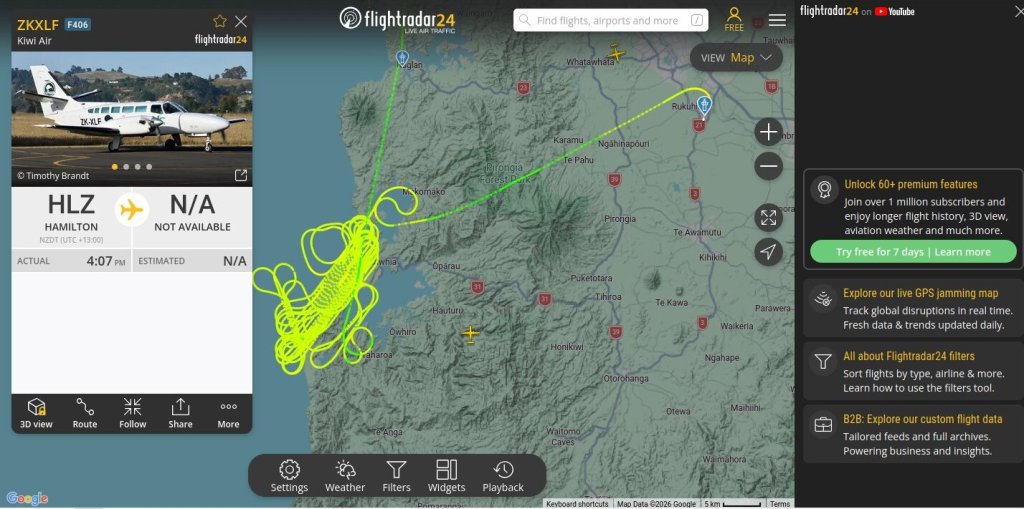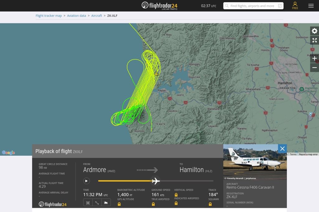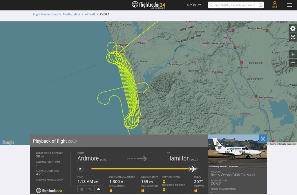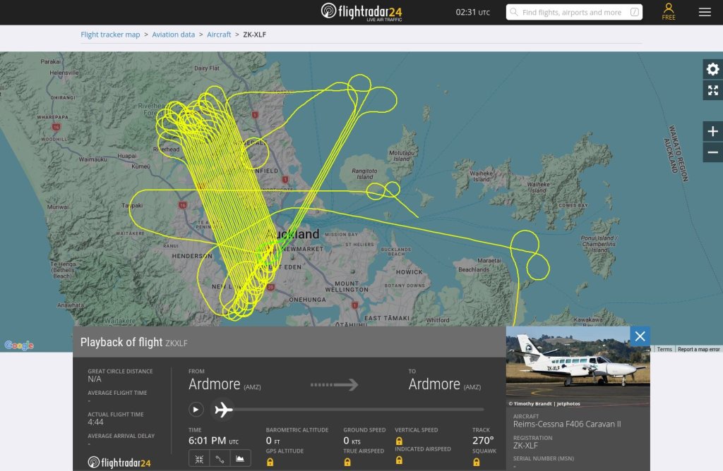
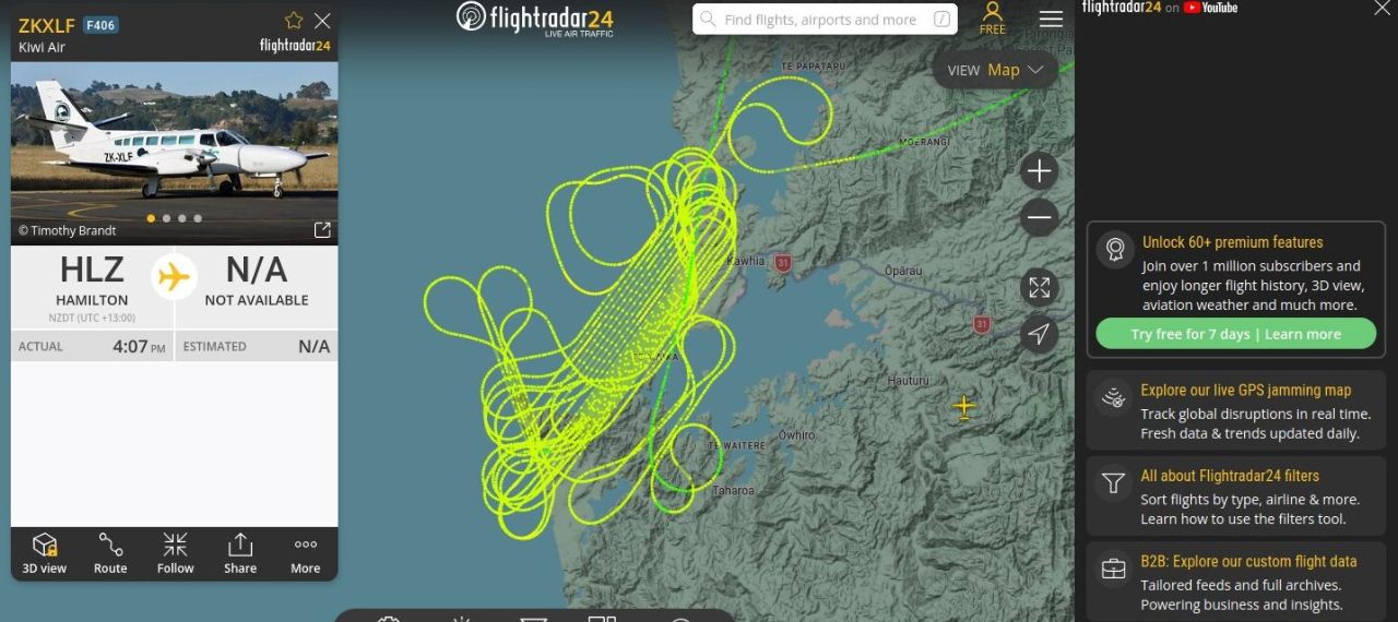
Following on from our last post on topic (please read the info there), below are tracked flight paths seen prior to the recent flooding in the Waikato region. A state of emergency was declared at Otorohanga on the 14th. This post records activity on and around the 12th February 2026. Similar seen over Auckland on the 10th. EWNZ
Waikato coastal flight paths
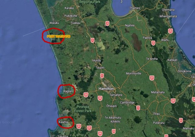
Flight paths recorded over 3 NI, West Coast regions, one above the other: Kawhia, Raglan and Port Waikato on 12th Feb 2026 . There was also a grid over Auckland on the 10th.
Same aircraft from Ardmore.
Ōtorohanga flooding in pictures: Residents wake to waist-deep water
Waikato weather: Ōtorohanga and Waipā districts join forces to combat flood damage
Otorohanga is inland from Kawhia.
(Time stamps on originals, edited for privacy)